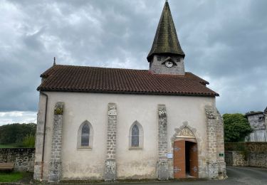
Trail Cycle La Souterraine - Creuse Cher Vélo - Photo
 cn29122
cn29122

User

© OpenStreetMap contributors
Length
Length
140 km
Max alt
Max alt
403 m
Uphill gradient
Uphill gradient
1438 m
Km-Effort
Km-Effort  
160 km
Min alt
Min alt
78 m
Downhill gradient
Downhill gradient
1719 m
Boucle
Boucle
No
Creation date :
2017-08-07 00:00:00.0
Updated on :
2017-08-07 00:00:00.0

(0 Reviews)

Cycle
Cycle
8h49
Difficulty : Difficult

Scan this QR Code to open this trail in the SityTrail application

FREE GPS app for hiking

Logo SityTrail SityTrail

IGN / Geographical institutes

Download SityTrail from the App Store Download SityTrail from Google Play

Logo SityTrail SityTrail World

The world is yours!

Download SityTrail from the App Store Download SityTrail from Google Play Download SityTrail on Huawei AppGallery

About

Trail Cycle of 140 km to be discovered at New Aquitaine, Creuse, La Souterraine. This trail is proposed by cn29122.

Elevation profile

Points of interest

Point of interest Saint-Hippolyte - 1199 - Photo
cn29122
SAINT-HIPPOLYTE 
Point of interest Loché-sur-Indrois - 1258 - Photo
cn29122
LOCHÉ-SUR-INDROIS 
Point of interest Saint-Gaultier - Camping - Photo
cn29122
SAINT-GAULTIER 
Point of interest Saint-Gaultier - Camping l'Oasis du Berry PI - Photo
cn29122
Point of interest Lignac - D32 - Photo
cn29122
LIGNAC 
Point of interest Lignac - D321 - Photo
cn29122
LIGNAC 
Point of interest Chalais - D442 - Photo
cn29122
CHALAIS 
Point of interest Rivarennes - D46 R Des Dames et D46 - Photo
cn29122
Point of interest Obterre - Le Cormier 0PI Zoo - Photo
cn29122
Point of interest Chemillé-sur-Indrois - Les coteaux du lac PI - Photo
cn29122
CHEMILLÉ-SUR-INDROIS 
Point of interest La Souterraine - Maison La Souterraine - Photo
cn29122
LA SOUTERRAINE 
Point of interest Obterre - Parc Zoologique - Photo
cn29122
Point of interest Couffy - Poulas - Photo
cn29122
COUFFY 
Point of interest Lignac - Vallée de lignac PI - Photo
cn29122
Point of interest Mézières-en-Brenne - Village Vacances Nature de Bellebouche 0PI - Photo
cn29122
MÉZIÈRES-EN-BRENNE 

Positioning

Country:
France
Region :
New Aquitaine
Department/Province :
Creuse
Municipality :
La Souterraine
Location:
Unknown
Start:(UTM)
383303 ; 5120787 (31T) N.

Trails nearby

Trail Equestrian Saint-Agnant-de-Versillat - Boucle Bridier Lavaud - Photo
Equestrian
Gus23

Equestrian

Medium
(1)
Saint-Agnant-de-Versillat, New Aquitaine, Creuse, France
17.6 km | 21 km-effort
35min
Yes
Trail Equestrian Saint-Maurice-la-Souterraine - Chemin en fête 01/10/17 - Photo
Equestrian
Gus23

Equestrian

Very easy
(1)
Saint-Maurice-la-Souterraine, New Aquitaine, Creuse, France
29 km | 35 km-effort
4h 21min
Yes
Trail Running La Souterraine - La drabble - Photo
Running
PEDAROUX

Running

Medium
(1)
La Souterraine, New Aquitaine, Creuse, France
11.8 km | 13.6 km-effort
1h 10min
Yes
Trail sport La Souterraine - Sob 21 La souterraine - Chamborand  - Photo
sport
Glurps

sport

Very easy
La Souterraine, New Aquitaine, Creuse, France
16.8 km | 19.9 km-effort
Unknown
No
Trail Walking Saint-Maurice-la-Souterraine - 2024 Creuse St Maurice la Souterraine  - Photo
Walking
jctbis

Walking

Medium
Saint-Maurice-la-Souterraine, New Aquitaine, Creuse, France
11.6 km | 13.5 km-effort
2h 43min
Yes
Trail Walking La Souterraine - La Souterraine  - Photo
Walking
jctbis

Walking

Easy
La Souterraine, New Aquitaine, Creuse, France
9.3 km | 11.1 km-effort
2h 3min
Yes
Trail Mountain bike La Souterraine - gpx-gt-vtt-1-2-vdef - Photo
Mountain bike
Gigot33

Mountain bike

Very difficult
La Souterraine, New Aquitaine, Creuse, France
410 km | 524 km-effort
36h 19min
No
Trail Walking La Souterraine - La Souterraine a Bénévent-l’Abbaye et Marcac - Photo
Walking
Nono55

Walking

Medium
La Souterraine, New Aquitaine, Creuse, France
35 km | 42 km-effort
7h 37min
No
Trail Mountain bike La Souterraine - gt-creuse-vtt - Photo
Mountain bike
topolino

Mountain bike

Very difficult
La Souterraine, New Aquitaine, Creuse, France
263 km | 335 km-effort
23h 15min
Yes


Close
My subscriptions